
Machesney Park ZIP Coverage
Official village and Winnebago County records consistently use 61115 for Machesney Park. Village Hall is listed at 300 Roosevelt Road, Machesney Park, IL 61115, and a January 2026 county taxing-district contact list uses the same postal line. That is strong support for 61115 as the core official label. It does not prove that each edge parcel uses that ZIP.
| ZIP | Area evidence | Postal service | Boundary note |
|---|---|---|---|
| 61115 | Official village address and county municipal records | Verify the station by exact address | Core Machesney Park label; edge addresses still need USPS review |
| 61111 | Official Loves Park and library addresses nearby | Nearby regional ZIP | No official proof found that it serves an incorporated village address |
| 61103 | Rockford county and public-health addresses | Rockford postal label | Not evidence of Machesney Park coverage |
| Other or special ZIP | No additional village ZIP verified | Check exact address | No PO-box-only or unique village ZIP confirmed |
This conservative table is deliberate. A nearby official address is not proof that its ZIP crosses the village line. The Machesney Park ZIP code directory therefore presents 61115 as confirmed and labels the rest as comparison points that need address-level evidence.
Verify Machesney Park ZIP Addresses
The USPS ZIP Code Lookup is the authority for delivery labels. Its three modes answer different questions. “By Address” accepts street address, city, and state. “By City & State” returns ZIPs tied to a postal city. “By ZIP” returns place information for the code entered. For an edge parcel, use the full address rather than relying on a city-wide result.
The USPS landing screen keeps all three routes together:
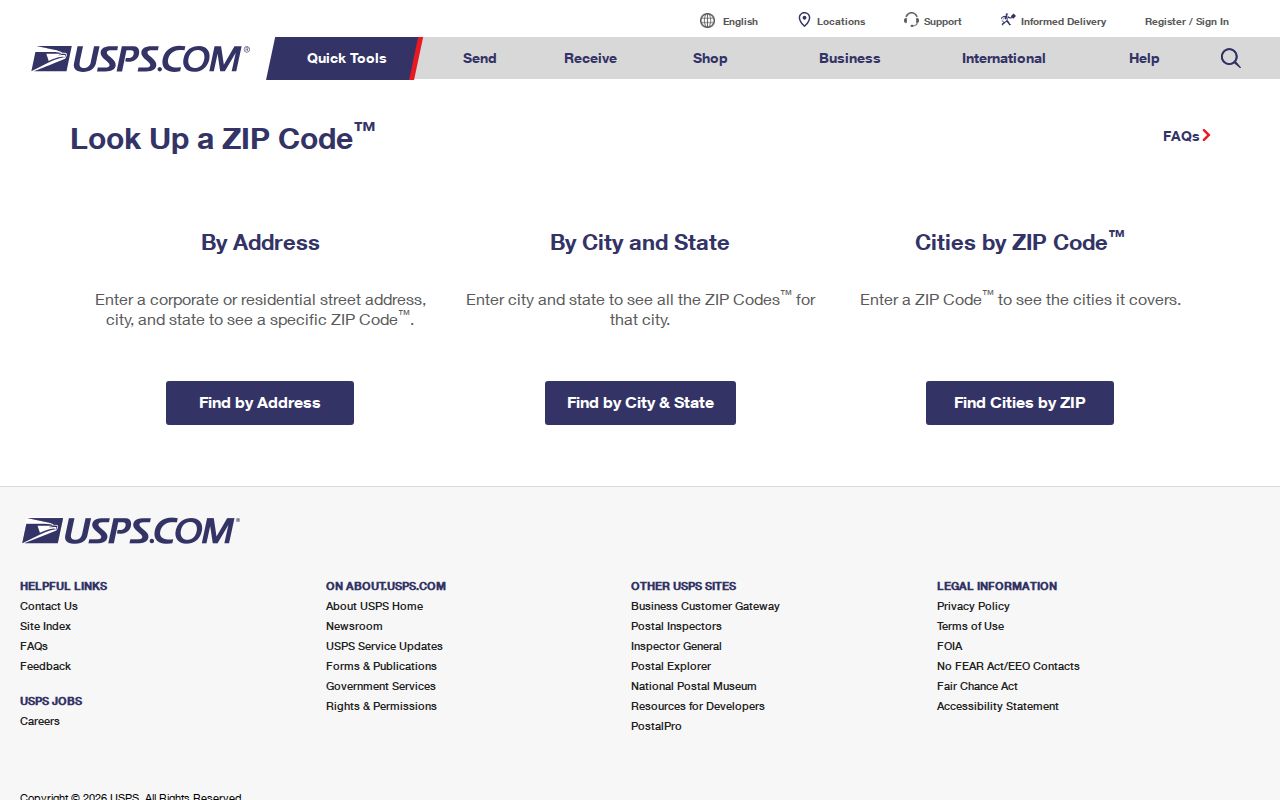
The tabs show why a city search and an address search are not substitutes. Save the result date, returned city, state, five-digit ZIP, and ZIP+4 when displayed.
A current servicing-station page for the village was not captured in the research. Call the USPS customer-service route for a disputed delivery address. PostalPro's AIS Viewer describes address-quality and City State/ZIP+4 data, but it is not a public list of residents.
Note: Use the exact street address for any Machesney Park edge parcel; the village mailing line alone cannot settle postal coverage.
Machesney Park ZIP Myths Nearby
61111 appears on official Loves Park and library addresses, while 61103 appears on official Rockford and county-health addresses. Those facts show that the codes are close to Machesney Park, not that either code serves land inside the village. Copying a broad online ZIP map into a resident search would turn proximity into an unsupported claim.
Use a simple proof test. First, ask USPS for the precise delivery line. Next, locate the parcel through WinGIS. Then check the Assessor PIN and taxing districts. If the city label, parcel boundary, and government jurisdiction differ, retain each field as a separate fact. Do not choose the one that seems most familiar.
No official source reviewed here documents a Machesney Park ZIP split, realignment year, PO-box-only code, unique institutional code, or complete edge-address map. Incorporation in 1981 does not establish when a postal label changed. Historical questions belong with USPS research tools and the local-history library.
Search Machesney Park Records by ZIP
Only a few official portals accept ZIP, and each answers a narrow question. The Illinois voter match requires a ZIP along with a person's name, birth date, street number, and street name. I-CASH accepts city and ZIP to narrow unclaimed-property claims. The state registry accepts city, county, and ZIP filters for its statutory purpose. None is a comprehensive list of people in 61115.
- Verify the delivery ZIP through USPS, using the complete address when one is known.
- Choose the record type. Do not use a claim database, registration match, or registry as a substitute for a resident roll.
- Enter the person's identifying fields required by that official form, including the verified ZIP where offered.
- Compare the result date and address with a parcel, document, or other lawful official source.
- Once the search narrows to a road, use the Machesney Park street directory for street-level work.
A no-match result also has a narrow meaning. It may reflect an incomplete name, a changed address, a protected record, an ineligible claim, or a source that never held the person. It does not show that someone is absent from the village.
Machesney Park ZIP Search Fields
The official Illinois voter registration lookup uses five-digit ZIP as a required narrowing key, but it does not permit a ZIP-wide browse. Street choices populate after the ZIP is entered, and the form still needs personal details. This makes it suitable for checking one's own registration match, not building a neighborhood list.
| Field | Input | Required | Format note |
|---|---|---|---|
| First Name | Text | Yes | Letters and spaces |
| Last Name | Text | Yes | Allows letters, spaces, hyphen, apostrophe |
| Birth Date | Text | Yes | Month, day, and year |
| Five Digit Zipcode | Text | Yes | Five digits |
| Street Number | Text | Yes | Loads after ZIP |
| Street Name | Select | Yes | Dynamic list after ZIP |
Illinois places limits on voter-file disclosure and use. For election-office help, use the Winnebago County election information route by phone, mail, or in person. A public-records request is not a way around those limits.
Machesney Park ZIP Portal Limits
The ZIP code directory works best when it states what each form cannot do. The Illinois Treasurer I-CASH search uses last or business name, first name, city, ZIP Code, and Property ID. It is free and updated weekly, but it is a claim database. A result shows possible unclaimed property, not current residence.
The I-CASH screen displays city and ZIP as optional narrowing fields:
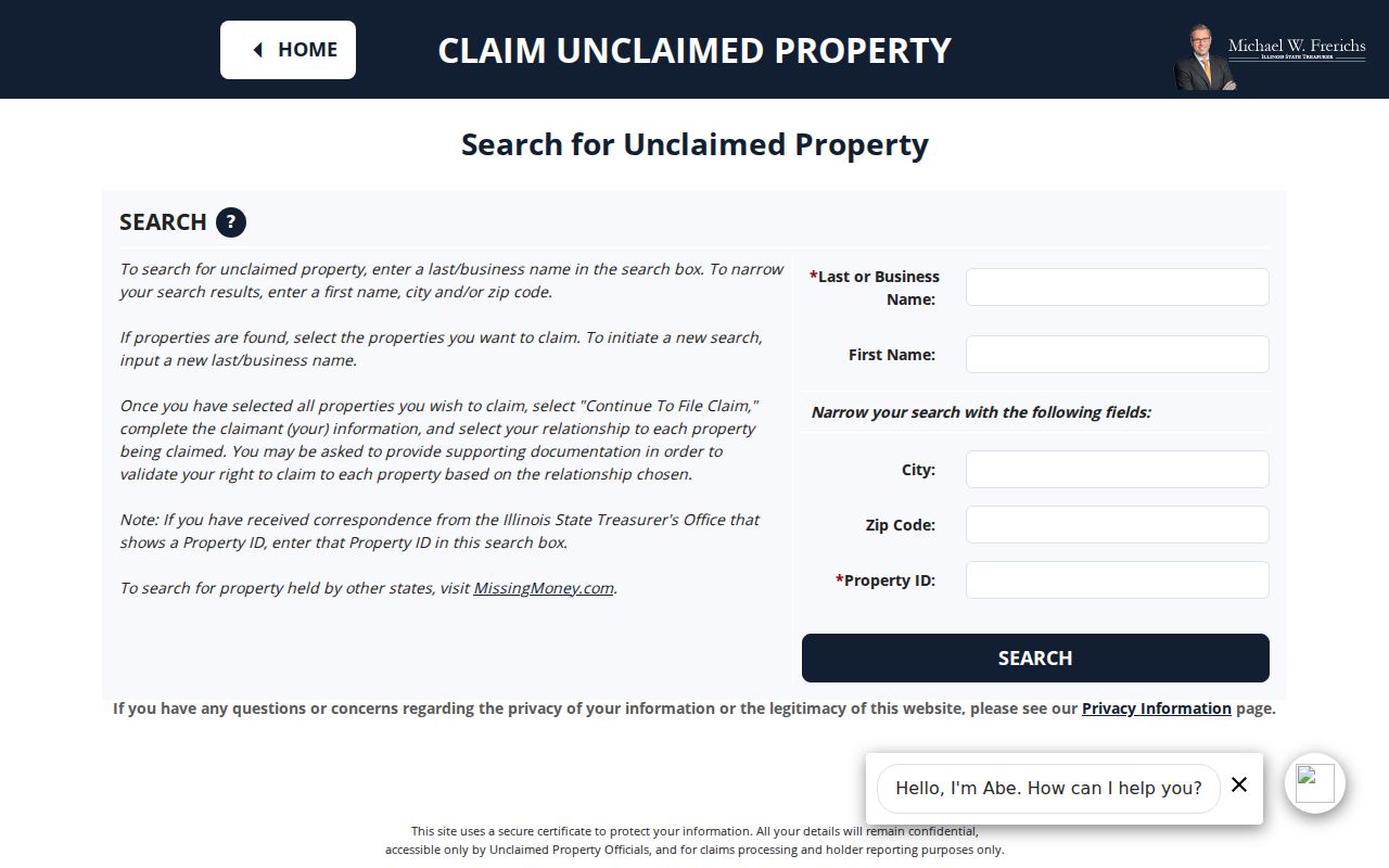
The form's name and Property ID fields keep the ZIP in its proper role as a filter rather than a resident list.
The Illinois State Police registry also exposes City, ZIP Code, County, status, and record-type controls for a specific statutory database.
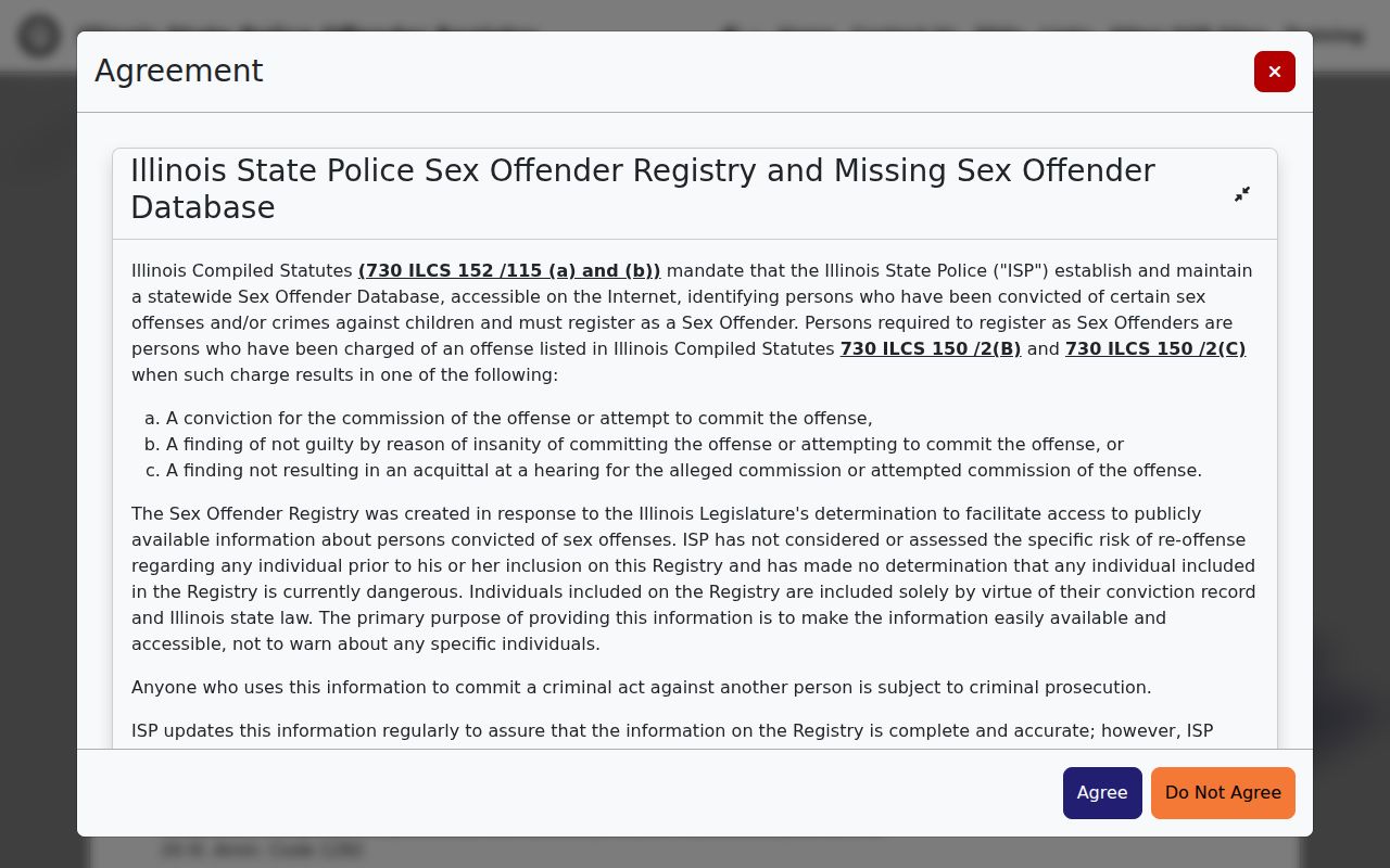
The registry screen illustrates another narrow ZIP-capable source. Its daily updates and warnings do not make it a general directory, and its information must never be used to threaten or harass anyone.
Machesney Park ZIP Boundary Differences
Three kinds of geography often get blended. USPS creates delivery ZIPs. The Census Bureau publishes ZIP Code Tabulation Areas, or ZCTAs, for statistics. Machesney Park and Winnebago County maintain legal, parcel, and taxing boundaries. A ZCTA approximates postal geography and is not a legal village boundary. WinGIS is better for parcel geometry, while USPS is better for the mailing line.
- ZIP code
- A USPS delivery code associated with addresses and routes, not a municipal border.
- ZIP+4
- The basic five digits plus four more that narrow a delivery segment.
- PO-box ZIP
- A code assigned to post-office-box delivery; none was verified specifically for Machesney Park.
- Unique ZIP
- A code assigned to one high-volume organization; none was confirmed for the village.
- Carrier route
- A postal delivery sequence that may cross boundaries and is not a resident roll.
A “Machesney Park” mailing line can coexist with county, township, water, sanitation, school, fire, or road records. The village's partners include North Park Public Water District, Four Rivers Sanitation Authority, three fire districts, and the Sheriff. Route a question to the agency that actually keeps the record.
Resolve a Machesney Park Edge Address
A street can cross a postal or government line without any obvious change on the ground. The most reliable Machesney Park ZIP code directory workflow preserves each source's answer instead of trying to collapse them into one boundary. It also makes later corrections easy because the query and date remain known.
- Run USPS By Address and save the standardized city, state, ZIP, and ZIP+4.
- Open WinGIS and identify the parcel polygon, municipal layer, nearby roads, and PIN.
- Check the Winnebago County Assessor by PIN or street components for parcel location and taxing information.
- Use county jurisdiction lists or the responsible road, utility, fire, or election office for the exact service question.
- For older labels, ask NSLD for plats, atlases, newspapers, and former street or place names.
The Assessor has no ZIP field. Citizenserve searches by address or parcel number, and WinGIS uses map, parcel, and address context. Those differences are useful: they test the local geography without pretending the postal code controls it.
In person or by phone, USPS can address delivery questions, while village and county staff can confirm their own official addresses and jurisdictions. A narrow Illinois FOIA request may obtain municipal or county address records, but it cannot obtain USPS internal delivery data or bypass voter restrictions.
Note: Record the query date because postal labels, map layers, and portal data can change at different times.